Click Image For Map (PDF)
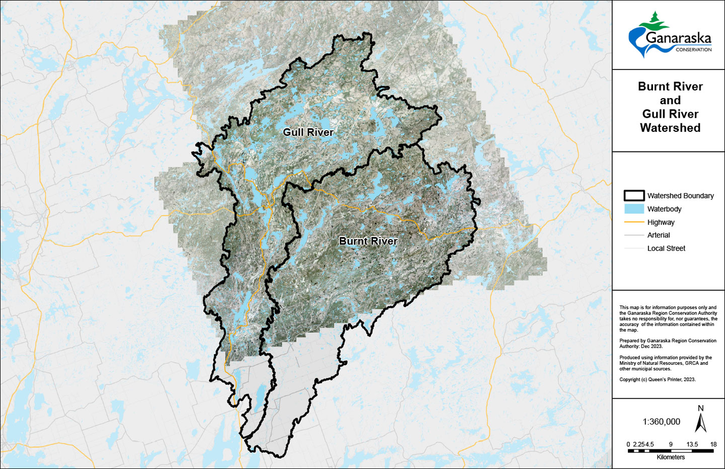
Haliburton Updated Floodplain Mapping Project
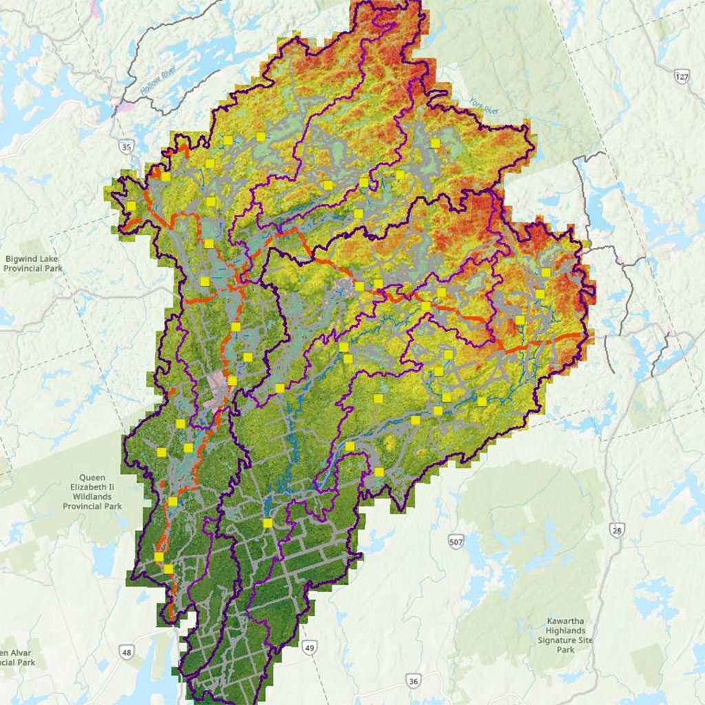
The County of Haliburton has partnered with the Ganaraska Region Conservation Authority (GRCA) and Kawartha Conservation to complete floodplain mapping for the Gull and Burnt Rivers.
This work also includes mapping of high water levels for numerous lakes within each watershed.
Floodplain mapping helps to identify areas that may be at risk of flooding during severe storms and is an important tool for land use planning and emergency preparedness.
This project is being funded in part by the Flood Hazard Identification & Mapping Program (FHIMP).
- The importance of floodplain mapping in building resilient communities is highlighted in the following article:
https://conservationontario.ca/conservation-authorities/flood-erosion-management/floodplain-mapping - Priority #1 of Ontario’s Flooding Strategy is “Understand Flood Risks”:
https://www.ontario.ca/page/protecting-people-property-ontarios-flooding-strategy
To find answers to some of the common questions asked about floodplain mapping and this update, take a look at our Frequently Asked Questions (FAQ) information sheet:
Property owners play an important role in flood prevention and preparedness. The following resources have been developed to help area residents take action to reduce their flood risk:
For further information about this study, contact the Project Technical Lead:
Cory Harris, P. Eng.
Watershed Services Coordinator
Ganaraska Region Conservation Authority
charris@grca.on.ca
905.885.8173 ext. 226
Project Timeline & Status
- Summer & Fall 2019
LiDAR data acquisition for rivers in study area - Summer 2021 – Summer 2023
Field Survey of Dam, Bridge and Culvert Structures - Summer – Fall 2021
Collection of Bathymetric Data for Priority Areas
- 2022 – 2023
Background Data Review and Development of GIS data products; Development of hydrologic and hydraulic models to support mapping; Development of High-Water Levels for key lakes - Winter 2024
Report & Map Production and Public Information Centre
Flood Hazard For Rivers
For the riverine systems, the Regional (Timmins) Storm, the climate-adjusted Timmins Storm, and the 100-year (1% Annual Exceedance Probability (AEP)) design storm were modelled as a part of this study.
The Flood Standard for the study area is defined as the storm event that produces the greatest level of flooding between the Regional (Timmins) and the 100-year event (1% AEP), in accordance with the Ministry of Natural Resources (MNR) Technical Guide - River & Stream Systems: Flooding Hazard Limit.
A flood event of higher magnitude than the flood hazard criteria zone will serve as a proxy scenario for climate change. The higher magnitude event is to be equal to or higher than a 200-year Flood (0.5% AEP). The climate change approach for the Timmins Storm follows the methodology described in ‘Incorporating Climate Change in Floodplain Mapping’ under FHIMP where the Regulatory Storm Event is Timmins or Hurricane Hazel (MNR, 2023). The Regional Storm climate change scenarios are based on the RCP4.5 emissions scenario using CMIP5 for the time horizon of 2050-2080 that was prescribed by the MNR.
While the climate change-adjusted Timmins Storm does not have any planning or regulatory status, it has been made available to the funders and the public for information and reference. A copy of the shapefile can be downloaded via the following link:
Flood Hazard For Lakes
Flood hazard limits were estimated for key lakes within the County based on Parks Canada – Trent Severn Waterway historic high water level records, plotted on the 2019 LiDAR-based digital terrain model (DTM). This is a cartographic product and not an engineered flood hazard limit.